|
|
NAVIGATING SUSTAINABILITY ON A CHANGING PLANET March 23-25, 2015, Norfolk, VA, USA |
|
WORKSHOP SCOPE AND OBJECTIVESOur planet is rapidly changing and moving out of the Holocene. Navigating and managing the changes and maintaining a sustainable development is complex. We need to have goals and targets related to sustainable development, understand the limits of what is a safe and sustainable development, know the ongoing changes, and have foresight about the impact of our actions on the planet. The workshop brought together the science that links our goals with the “navigation tools,” that is, the indicators of change, and the Earth observations required to quantify these indicators. A main outcome of the United Nations Conference on Sustainable Development (Rio+20), held in June 2012 in Rio de Janeiro, was the agreement by Member States to initiate a process to develop a set of “Sustainable Development Goals” (SDGs). Motivated by the partial success during the decade from 2005 to 2015 of achieving the “Millennium Development Goals” (MDGs), the SGDs would serve as the driver for progress towards the decade from 2015 to 2025. Since RIO+20, a number of groups have been active in developing the set of goals, with the Open Working Group on Sustainable Development (OWG) being central in the process. In July 2014, the OWG published its proposal for the SGDs (see the Outcome Documents of the 13th Session of the OWG), and in December 2014, the Secretary General added a synthesis report detailing The Road to Dignity. Both, for MDGs and SDGs, metrics that can measure progress towards the goals are important. The OWG has identified a set of indicators for the SDGs, which aim for consistency with the indicators used for the MDGs. These indicators are currently refined by technical teams. Many of these indicators are environment-related and require comprehensive Earth observations for a reliable quantification. The concept of a safe operating space for humanity (SOSH) is central to sustainability. The global boundaries of the SOSH are partly known quantitatively, and partly blured, with potential thresholds still unknown. A better quantification of the boundaries and a monitoring of the state of the planet with respect to these boundaries depends on comprehensive Earth observations. Major scientific organizations have identified grand research challenges that need to be addressed in order to provide the knowledge needed to make progress towards global sustainability. The required research also depends on a comprehensive and accessible Earth observation database. Research innovations are needed at many scales to address the grand challenges and to make progress towards the societal goals. The Group on Earth Observations (GEO) is implemented the Global Earth Observation System of Systems (GEOSS) with the goal to improve access to, and the use of, Earth observations for a broad range of stakeholders. The 10 Year Implementation Plan for GEOSS endorsed by a Ministerial Summit in 2005 states “GEOSS was a step toward addressing the challenges articulated by United Nations Millennium Declaration and the 2002 World Summit on Sustainable Development, including the achievement of the Millennium Development Goals. GEOSS will also further the implementation of international environmental treaty obligations.” The recent Ministerial Summit on Earth Observation held in January 2014 in Geneva (see meeting documents) underlined the importance of the SGDs and of GEO focusing the development of GEOSS on the information needs that arise from humanity's quest for the SGDs. The Implementation Plan Working Group (IPWG) initiated during the Ministerial Summit in 2014 with the mandate to draft the next 10 Year Implementation Plan for GEOSS provided in March 2015 a first report summarizing the first “reflective phase” of the IPWG and laying out the scheme for the further development of GEOSS. At the XI GEO Plenary, the IPWG provided a draft Strategic Plan. The workshop built on these reports and discussed the science and metric needed to achieve the goals indicated in these report. With this in mind, the 3rd GEOSS S&T Stakeholder Workshop focussed on the knowledge needs of the global and national decision makers to enable progress towards global sustainability on a changing planet. The workshop used the priorities of the discusion on the SGDs, the preliminary indicators, the grand challenges, and the global boundaries of the SOSH as a starting point in the discussion of the science of sustainability indicators with the goal to derive a comprehensive sustainability metrics. The workshop addressed to what extent the current and planned Earth observation systems would allow a quantification of the indicators comprising this metrics. Outcomes of the workshop include a refined set of global sustainability indicators, the essential variables required to quantify these indicators, and an assessment of the capability of current and future Earth observation systems to provide observations of these essential variable with sufficient spatial and temporal resolution, accuracy, and latency. Scientists and researchers engaged in environmental research supporting the current MDGs and the future SDGs and addressing the grand challenges are key stakeholders of GEOSS. Aligning the governing strategy for the implementation of GEOSS to the needs of these stakeholders has a high priority for GEO. The workshop reviewed the support of GEOSS for research on global sustainability and provided guidance on how to improve this support. GEO and GEOSSThe Group on Earth Observations (GEO) is implemented the Global Earth Observation System of Systems (GEOSS) with the goal to improve access to, and the use of, Earth observations for a broad range of stakeholders. The 10 Year Implementation Plan for GEOSS endorsed by a Ministerial Summit in 2005 states “GEOSS is a step toward addressing the challenges articulated by United Nations Millennium Declaration and the 2002 World Summit on Sustainable Development, including the achievement of the Millennium Development Goals. GEOSS will also further the implementation of international environmental treaty obligations.” The recent Ministerial Summit on Earth Observation held in January 2014 in Geneva underlined the importance of the SGDs and of GEO focusing the development of GEOSS on the information needs that arise from humanity's quest for the SGDs. The Implementation Plan Working Group (IPWG) initiated during the Ministerial Summit in 2014 with the mandate to draft the next 10 Year Implementation Plan for GEOSS provided in March 2015 a first report summarizing the first “reflective phase” of the IPWG and laying out the scheme for the further development of GEOSS. They also presented a Draft Strategic Plan to the GEO PLenary in November 2014. The GSTS Workshops built on these documents and discuss the science and metric needed to achieve the goals indicated in the documents. OUTPUT
SESSION OVERVIEWThe program includes plenary session that will feature invited high-level presentations to introduce core themes. Subsequent breakout sessions will focus on sub-themes and consist of short presentations, panels, and discussions. After each breakout sessions, a plenary session will summarize the outcomes of the breakout sessions and provide input for subsequent sessions. The following sessions are proposed:
DETAILED SESSION DESCRIPTIONSPlenary Session 1: Assessing and Managing the Changes: The Metrics Co-Chairs: Hans-Peter Plag, Stefano Nativi This session summarized the knowledge about indicators for the state and trends in the Earth system, including the social component of this system. Particular focus was on indicator related to the SDGs, the SOSH, and sustainable development in general. The presentations took a starting point in the science behind the indicators. Breakout Sessions Block 1: Designing the Metrics In the first block of breakout sessions, themes focused on specific goal sets and the indicators used in relation to these goals. The sessions reviewed to what extent the indicators are linked to essential variables of the Earth system. The objective was to discuss and draft sets of essential variables for each of the goal sets. Breakout Session 1.1: Sustainable Development Goals, Global Boundaries, and Safe Operating Space for Humanity Chairs: Hans-Peter Plag; Rapporteur: Senay Habtezion Breakout Session 1.2: GEO Societal Benefit Areas Chairs: Antonio Bombelli; Rapporteur: Mark Bourassa Plenary Session 2: Assessment of the Metrics Chair: Jay Pearlman Based on the previous plenary and breakout sessions, an assessment of the available metrics in terms of completeness, applicability, and decision support was attempted. Plenary Session 3: Monitoring and Foreseeing the Changes: The Role of Earth Observations Co-Chairs: Paola Campus, Andiswa Mlisa Quantification of the indicators, the metrics, requires observations of the essential variables required to determine the changes in the indicators. This session compared the available and anticipated observations of essential variables to the needs arising from the task, which is to navigating a sustainable development on a rapidly changing, dynamic planet. The session aimed to highlight main social, economic, scientific, technical issues and what is already available to target the issues, as well as identify the current shortcomings and future needs/recommendations. Breakout Sessions Block 2: Quantifying the Metrics Based on the outcome of the breakout session of the first day, the breakout sessions will consider the sets of essential variables for several goal sets (SDGs, SBAs, SOSH) and discuss availability and applicability of data for these essential variables that would allow quantification of these goal-related indicators. Breakout Session 2.1: Essential Variables for Sustainable Development Goals, Global Boundaries and Safe Operating Space for Humanity Chair: Hans-Peter Plag, Rapporteur: Senay Habtezion Several of the proposed SDG indicators will be used as examples to discuss the status to which EVs are identified for these indicators. Breakout Session 2.2: Essential Variables for GEO Societal Benefit Areas Chair: Antonio Bombelli, Rapporteur: Kathy Fontaine Several of the GEO SBAs have started processes towards the identification of EVs. The breakout session will review the status of these initiatives and their approaches to linking these EVs to metrics. The goal is to give recommendations how a consistent process could be developed to be used in all SBA areas. Plenary Session 4: Setting Priorities Chair: Wolfgang Grabs Based on the previous sessions, priorities for Earth observations were discussed and translated into recommendations. Joint Plenary Session A: Changing Science for a Changing Planet Co-Chair: Hans-Peter Plag, James Syvitski The rapid changes in key variables of the planet (for example, biodiversity, atmospheric chemistry, ocean heat content, water cycle and sediment transport, ocean acidity, land cover, ice sheets, sea level) that are already taking place and expected to increase can lead to severe challenges for humanity. We need to ask whether the current approach to science will be able to identify these challenges in a timely manner and provide the practice-relevant knowledge needed to address the challenges or whether a new approach to rapid knowledge creation is needed. Joint Breakout Sessions: Creating the practice-relevant knowledge to cope with global change The breakout sessions reviewed methods for knowledge creation related to key areas of global change and consider the possibilities of rapid changes that might challenge the traditional scientific approach. Joint Breakout Session 1: Intelligent use of data quantity vs focusing on data quality Chair: Stefano Nativi; Rapporteur: Bart de Lathouwer The new Web 2.0 environment has impacted economy with what is termed "wikinomics" by Don Tapscott and Anthony Williams and shifted the basis to four principles: openness, peering, sharing and acting globally. How is the Web 2.0 impacting the generation and use of data and knowledge? How can, and how should, classical Earth observation with a focus on data quality make use of the new technologies where the data quantity provides for new ways of extracting information and knowledge from the huge amount of data available now? How can new approaches of co-design of research agendas for problem solutions and co-creation of knowledge help make use of data quantity? Joint Breakout Session 2: Shifting from disciplinary to problem and solution focused science Chair: Kathy Fontaine; Rapporteur: Andiswa Mlisa The complexity of global change, climate change, and sustainability requires a transition from a bottom-up, discipline-based approach that often addresses complexity by simplification, to a top-down approach starting at the problem and recognizing the full scale of complexity. How can observation be used to provide the constraints and evidence for such an problem and solution-oriented approach? Joint Breakout Session 3: Avoiding Type II errors Chair: Hans-Peter Plag Current global and climate change science and science relevant to societal sustainability science is focused more on avoiding Type I errors, that is, "false positives" (false alarms), than avoiding Tyoe II erros, that is, "false negatives" (missed alarms). The session will look at whether focusing on Type I errors will allow us to identify and avoid severe thresholds (like crossing the global boundaries of the safe operating space for humanity) before it is too late. The threshold discussion used by, e.g., Tim Lenton and Jim White, raises the question whether it would be better to focus also on Type II errors. Is the transition out of the Holocene a time where Type II errors are more critical, and if so, how would a science look like and be organized if the main emphasis is on avoiding Type II errors? How would that impact the relevance of observations and the prioritizing of observation systems? Joint Plenary Session B: Linking Societal Goals, Science, Metrics, and Observation Systems Co-Chairs: Stefano Nativi, Hans-Peter Plag In this second joint session, the aim was to bring together science and goal-based metrics in order to better understand the requirements on future observing systems that provide the data required to quantify the metrics and enable applications with societal benefits. PROGRAM AND SCHEDULEPROGRAMFor room information, see the Schedule. Monday, March 23, 2015
Tuesday, March 24, 2015
Wednesday, March 25, 2015
SCHEDULEOverview Week March 23-27, 2015
ABSTRACTSGEOSS Water Services: Federating Regional and National Water Data David Arctur, University of Texas at Austin Since 2012, the Water SBA team for the GEOSS Architecture Implementation Pilot (AIP) has helped water data agencies in several countries to implement and publish standards-based water resource information. The following water data providers and research centers have developed a consistent implementation of this framework, which are or will soon be searchable in GEOSS:
Continued development and expansion of this network will bring within reach the ability to study and understand water data across and among whole continents, on demand. The emphasis in the upcoming 2015 cycle will be the application of this GEOSS Water Services framework for flood monitoring, prediction, and mitigation. Integration of EO and in-situ data through expert knowledge for habitats and ecosystems monitoring P. Blonda, C. Marangi, A. Adamo, C. Tarantino, F. Lovergine Expert knowledge can be used to develop a descriptive scheme, based on ontologies, of habitats (as proxies for species), ecosystems, ecosystem services and their interactions/functions and related Indicators and variables such as Essential Biodiversity Variables (EBV), Essential Ecosystem Variables (EEV). The main objective is to design and develop a pre-operational cost-effective environmental monitoring system able to integrate EO and in-situ data, based on the elicitation of such knowledge. The system should provide as outputs series of thematic maps (LCLU and habitats, ecosystems, with these based on MAES report definition) and extract indicators and essential variables (EV) to be used as inputs to change detection and modelling tools. The experience developed in the FP7 BIO_SOS project will be described as basis for future research within the Horizon2020 Ecopotential project. Essential Observations for the Oceans Mark A. Bourassa, Center for Ocean-Atmosphere Prediction Studies, Florida State University, Tallahassee, FL Co-chair Ocean Observation Panel for Climate The ocean observations that are deemed (by national and international organizations) as important and feasible to observe with sufficient accuracy as Essential Climate Variables (ECVs) or as Essential Ocean Variables (EOVs). These variables have been well established for physical oceanography, and some have been established for the biogeochemistry. The biological community is working towards suggesting EOVs to the national and international organizations that are charged with selecting these variables and setting the observational goals. Decades ago, the physical oceanography, atmospheric, and terrestrial ECVs were determined with the goal of addressing climate variability in the context of societal issues and related science questions. The Essential Ocean Variables were developed later, with goals beyond climate: weather forecasting, transport, recreation and others. They are similar to the ECVs, but also address issues such as the delay between observations being taken and being made available, as well as the differences in quality between near real-time data and delayed mode data (which often has more rigorous quality control and adjustments to improve accuracy). A short overview of ECVs and EOVs will be given, with a short explanation of some of the differences. Efforts are ongoing to better select and explain the need for ECVs and EOVs. Therefore this is a time when outreach and interaction will have their maximum benefit. A question that is currently being pondered is how to take advantage of established components of the observing system (typically physical variables) to more rapidly develop and deploy less mature components of the observing system (chemical and biological variables). Key issues are structural compatibility and changes in cost, operational life time, and infrastructure needs. For example, the cost and availability of ship time influences the goals for operational lifetime. The sampling needs and the advantage of collocated variables is another critical consideration. For example, the usefulness of many biogeochemical variables is greatly enhanced by collocation with physical variables, and vice versa. Another factor in considering how these observations should be combined is the links to societal and science drivers, which are in turn linked to global conventions and mandates. New efforts to describe these links will be described and demonstrated. The approach shown highlights the different applications to which the observations apply. Automatization of information extraction to build up a crowd-sourced reference database for vegetation changes Jonas Eberle, Christian Hüttich, Christiane Schmullius; Friedrich-Schiller-University Jena, Institute for Geography, Department for Earth Observation, Jena, Germany Scientists can benefit from the wide range of data quantity if their algorithms are made available to the public in an easy-to-use manner. Automated data access in combination with the follow-up execution of algorithms can help to test algorithms in different regions around the world and lead to new information based on the knowledge of local users. In the example of vegetation change analysis based on Earth Observation time-series data, we can provide lots of data for the validation of changes detected by scientific algorithms, e.g., true/false color images, fire data, weather data. Based on these input users can validate the algorithm in their study areas. Furthermore, they can build up a database with change areas that can be used as reference databases on other analysis tools (e.g., change classifications). Based on the bfast (Breaks For Additive Season and Trend) algorithm we can detect vegetation changes in time-series data. For the validation of a detected “break” we will search automatically for other datasets at the detected date of break and provide these data in an easy-to-use web portal. So users can execute the algorithm for change detection and validate the detected changes. A crowd-sourced reference database can be build up on areas where change occurred and this change was validated by users. Such a crowd-sourced initiative can help scientists to better understand algorithms for information extraction. The authors of an algorithm can benefit from the input of users that are testing the algorithm. The Web 2.0 leads us to a new way of how algorithms can be tested and how we can build up reference databases with areas around the world. Thus, Earth Observation time-series data are better useable and lead to new knowledge to further improve algorithms and validated reference information. In this presentation the author will describe the developments made for automated data access in combination with automated data analysis based on Earth Observation vegetation time-series data with no need to process any data by the users. What We Know and What We Don&srquo;t Know About Sea Level Benjamin Hamlington, Center for Coastal Physical Oceanography, Old Dominion University, Norfolk, VA, USA The change of sea level in response to the warming of our planet is of great interest for both scientific and socio-economic reasons. Sea level change has enormous socio-economic implications for the planet as coastal populations become more susceptible to storm surges and eventually inundation from the oceans. In addition, sea level is an essential climate variable and critical indicator of how our planet is responding to climate change. Sea level, when averaged globally, responds primarily to the amount of heat absorbed by the oceans, and the melting of land ice. Thus, many groups—climate scientists, politicians, economists, insurance companies, public utilities, coastal property owners, civil engineers, and other “stakeholders”—have a need for accurate and reliable projections of future sea level change and its regional variations. Projecting sea level change begins with improving our understanding of past sea level change and the factors contributing to it. On a local level, the sea level problem is complex due to its multi-facetted and coupled nature, involving essentially all Earth System components, and including multiple feedbacks. In the past decade, the network of observing systems has grown to be able to measure more of the factors contributing to sea level than ever before. This has led to significant advances in our understanding of sea level change in the past, present and future, while also aiding model efforts to project future regional sea level rise. Despite this, significant gaps in our understanding remain that have important implications for our ability to prepare for climate change in the coming years. In this presentation, we take stock of what we currently know and what needs to be understood better regarding sea level rise on global and regional scales. Although the focus is on sea level, the discussion here can be similarly extended to other areas, underscoring the need for improved understanding of all essential climate variables. Anticipating tipping points Tim Lenton, Earth System Science, University of Exeter, Exeter, U.K. A ‘tipping point’ occurs when a small change in forcing triggers a strongly non-linear response in the internal dynamics of a system, qualitatively changing its future state. Large-scale ‘tipping elements’ have been identified in the Earth’s climate system that may pass a tipping point under human-induced global change this century (Lenton et al. (2008) PNAS 105: 1786-1793). Such abrupt, non-linear changes are likely to have large impacts, but our capacity to forecast them has historically been poor. Recently, much excitement has been generated by the possibility that approaching tipping points carry generic early warning signals (Scheffer et al. (2009) Nature 461: 53-59; Lenton (2011) Nature Climate Change 1: 201-209). I will introduce the theory and prospects for gaining early warning of approaching climate tipping points. Promising methods are based on detecting ‘critical slowing down’ in the rate a system recovers from small perturbations, and on characteristic changes in the statistical distribution of its behaviour (e.g. increasing variability). Early warning signals have been found in paleo-climate data approaching past abrupt transitions, in models being gradually forced past tipping points, and in analysis of recent Arctic climate data. I will discuss the outstanding challenge of how to design a tipping point early warning system and how to identify the ‘essential variables’ to monitor in specific target systems. The Next Revolution for the GEOSS Common Infrastructure Stefano Nativi, Institute of Atmospheric Pollution Research of the National Research Council of Italy (CNR-IIA), Sesto Fiorentino, Italy GCI has faced some important (technological) revolutions in the past 10 years. Entering in its next decade, GEOSS and the GCI are going to face a new important revolution, including Pico satellites and Internet of Things, Big Data Analytics and Knowledge generation, Citizen Observatories and Consumerization. This presentation will introduce the present GCI architecture, discussing its flexibility and introducing its possible extension to address the next challenges. Future Earth Research Challenges Dennis Ojima, Colorado State University, US Global Hub of the Future Earth Executive Secretariat, School of Global Environmental Sustainability, Fort Collins, CO, USA The primary mission of Future Earth is to align the global change research community with decision makers and innovators of change to co-develop pathways for sustainable development and transformation to sustainability. Future Earth provides a platform to analysis and development of strategies to enhance resilience and preparedness to global change in regions and ecosystems across the globe. Future Earth has enhanced trans-disciplinary research and engagement activities across a suite of issues (e.g., food security, energy, public health, water, biodiversity loss) and public and private sector partners related to development, risk reduction, and strategies to more sustainable use of ecosystem services and natural capital. Regional to global research across multiple sectors will require greater integrated observations platforms and analysis tools. Inter-operability across and between earth system parameters and societal information will be needed to provide decision makers in the public and private sector the knowledge needed to make science based decisions on assets being managed. Current global tools provide aggregate analysis of certain aspects of the earth system, however greater granularity of integration and analysis will be necessary for management decisions by regional to local decisions makers. Social-ecological systems which bring together observations and analysis of multiple capital ranging from natural capitals to social, physical, and institutional capitals will provide an integration platform of information and knowledge. Developing this information for decision making will need to provide the information at the scale and metrics used currently by decision makers. The translation of observations and analysis will need to be co-designed with various sectors and end-users. Further research and innovation will be needed to finalize the co-production of information useful to these end-users. Future Earth will focus on the societal challenges identified in the 2015 Vision report and utilize these to aggregate the various SDG indicators across these 8 different domains of interest to Future Earth. The eight Challenges are to:
The Need For A New Science to Guide Humanity's Transition Into The Post-Holocene Hans-Peter Plag, Mitigation and Adaptation Research Institute, Old Dominion University, Norfolk, VA, USA; Shelley Jules-Plag, Tiwah, USA Humanity has left the Holocene and the “safe operating space for humanity” it provided to us. The Holocene, the last geological epoch that began about 11,700 years ago, had an exceptionally stable climate that allowed human beings to settle in one place for a long time and to learn agriculture. With 6,000 years of a stable sea level humans were able to build long-term settlements in river deltas and benefit from the rich ecosystem services and logistical advantages of being at a river and the coast. During the last hundred years, many things have changed very rapidly: we grew in numbers several hundered times faster than ever before, our energy usage grew 1,600 times faster, and inequality among humans grew 100 times faster. These rapid changes led to an increase of atmospheric carbon dioxide about 600 times faster than during the Holocene, temperature changed more than 100 times faster, and extinction rates of at-risk species increased dramatically. While we have seen many environmental factors changing rapidly, others are lagging behind and will soon exhibit accelerated changes. Sea level in particular has the potential to rise rapidly and threaten our global society. We have replaced the time of stability by a time of rapid change, making the future for our children very uncertain. The planet is on a trajectory that is rapidly moving us away from the safe operating space. We discover thresholds normally (with a few exception) by crossing them. The rapid degradation of the Earth's life-suport system resembles the situation of a patient in the emergency room with rapidly degrading organs. The best news out of the emergency room is that the patient is stable, and the on-going changes within humanity and in the Earth's life-support system do not signal that this is the news about humanity in the emergency room. Safeguarding the future requires a major paradigm shift in which we work towards slowing down these rapid changes so that we can reach a new equilibrium with the planet and it's life-support system. Our economy needs to safeguard the Earth’s life-support systems on which we and all future generations depend, instead of aiming for more wealth for a few. Our goal needs to be equity among humans both in time and space. Current science is not explictly focusing on the knowledge needs that arise from this existential challenge to reach equilibrium and restore stability. If such knowledge emerges, it is a bi-product. We do not have a science adapted to being in the emergency room, and while there are emerging research activities that aim to find ways for humanity to thrive without degrading the Earth’s life support systems, there is no strategic science framework that would bring these initiative coherently into a major effort of humanity to generate the knowledge we need to meet the challenge. There is also a need for a coupled tactical science that could respond to rapidly developing new threats, which we should expect as a consequence of the rapid changes we are enforcing on the system that supports our life. With such a framework, science could generate the knowledge to be integrated into decision making for a safe journey into the uncertain future of the Post-Holocene. Like in the emergency room, having the observing system that provides comprehensive information about the states and trends of the both humnaity and the life-support systems is crucial for global governance to make informed decisions how to react to rapid changes and new developments. Science and Society: Symbiotic or Askew? Dork Sahagian, Earth and Environmental Sciences, Lehigh University, Bethlehem, PA, USA Science has a long history of serving society, from the harnessing of fire, to development of tools and technology for commerce and war, and now to addressing global issues. In long-term symbiosis, science provided social systems with the knowledge required for development and security, while society ensured that the scientific community had the resources and support needed to function most effectively. In modern times, 20th century scientists were viewed like “industrialists,” working to exploit natural resources for growing economies in an “open world” in which consumption and disposal were accommodated by the physical, chemical, and biological processes throughout the global ecosystem. In the 21st century, however, society is increasingly treating scientists as “physicians,” turning to the scientific community to find ways to repair damage caused by overexploitation of the very resources that enabled rapid economic development, and that are now in jeopardy. As societies begin to understand that their economies and long-term well-being depend on the rate at which the global and local environment provide a broad spectrum of good and services, and that this rate is rapidly declining due to overexploitation, science is in a position to provide the knowledge necessary to restore the rate of provision of these goods and services. In effect, we are “living off the interest” that the stock within the global ecosystem provides, but in recent decades, we have rapidly “eaten into the principal” thus reducing the “interest,” just when we need to increase it due to the burgeoning human population’s demand for energy, food, and material goods. Although the modern scientific community has been aware of this unsustainable situation, communication between science and society has fallen to all-time lows in many areas, rendering science and society askew in that they are operating toward different goals, and the gulf widens. As a result, political decisions are often made that exacerbate the reduction of ecosystem goods and services, while the scientific community is marginalized in its influence on the political process. In 2000, at the turn of the century, the International Geosphere Biosphere Programme followed on the approach of the 19th century mathematician, David Gilbert, and challenged 21st century scientists with 23 difficult questions, the answers to which could provide the guidance needed to restore and sustain the rate of provision of environmental goods and services that would support future societies. Some of these questions pertain to the operation of the Earth system, while others are more strategic, relating to societal goals. One of the most difficult of these was the question “What kind of nature do societies want?” This kind of normative question is not subject to scientific analysis, but relies on an organized vision regarding the future of each society’s relation with the natural environment and what it provides. While society needs from science the answers to such questions and many others, science needs the support of society to make any progress at all toward answering them. As the gulf between the scientific and political communities widens, global environmental issues are often politicized and support is reduced for the very scientific community that could help ease the transition into a sustainable relation with the global ecosystem. For example, the U.N. Millennium Goals include the eradication of poverty, and the Post-2015 Agenda involves stabilization of global climate. Yet, research on climate change is being stifled in some key societies. Aggressive policies based on the best scientific insights available at this point will be necessary in order for these two U.N. goals not to be in direct conflict. As scientific techniques, models and results become more complex, the distancing from mainstream society is exacerbated by numerous misconceptions and miscommunications. These include concepts such as truth, objectivity, uncertainty, and underlying motivations. Miscommunication is sometimes caused by drastically different vernacular in scientific and lay circles. Scientists have become notorious for speaking in terms that make sense strictly in a scientific context, but not in a social or political context, in vain attempts toward “turning them all into scientists.” While we would like to think that the entire citizenry should become scientifically astute, this approach is clearly untenable. Yet, only an informed populace can appreciate and thus benefit from the role of science in decision-making. So a critical question becomes “How can we most effectively provide scientific results and understanding to the general population in the face of rampant misinformation promoted by those in whose short-term interest it is to prevent decision-making based on science?” The way forward necessarily involves a scientific community that understands and works within the value system of the society that depends on it (and that it depends on). This requires “speaking their language” not only in words, but in context. As such, outreach and education efforts on the part of scientists need to be both re-oriented and intensified. While decisions regarding resource consumption and distribution, human population, and the logical basis for decision-making may appear obvious to scientists, understanding that the world-view of much of the population is quite different will enable the scientific community to more effectively provide the needed insights in the service of society. Use of Surface-Dynamic Models for Identifying Environmental Indicators and Processes JP Syvitski, Community Surface Dynamics Modeling System — CSDMS, University of Colorado, Boulder, CO, USA The three pillars of 21st century environmental cyber-infrastructure are: 1) satellite observations, 2) field observations, and 3) model simulations. While our 20th century efforts using this combination are legion, we now recognize the effort to develop effective state-of-the-art operational workflows. Each of the three pillars, on their own, contains substantive bias and error. Field observations also tend to be expensive and seldom offer the same spatial coverage as satellite systems or numerical models. Satellite systems have both spatial and temporal restrictions, based on the nature of the orbit, data transfer limitations, and other environmental restrictions (e.g. cloud cover, atmospheric moisture). Model simulations offer great temporal and spatial resolution, but are labor-intensive, and affected by model simplicity, computational resources, and efficiency of the code itself. However when combined, these cyber-infrastructure pillars offer greatly reduced bias and error. Three examples highlight the role of model simulations in 21st century environmental cyber-infrastructure. The first example highlights the application of nested and coupled models used to assess the role of hurricanes on offshore infrastructure. The Gulf of Mexico is a mature offshore petroleum production area generating more than 1.7 mb of oil per day, through more than 3,500 oil platforms, connected by 28,000 miles of underwater pipes, all exposed to different types of structural damage associated with extreme oceanic and atmospheric events. About 5% of broken or damaged underwater pipes are by sudden and violent sediment flows. Short-lived hurricanes can generate 10m waves during their passage and both liquefy and re-suspend seafloor sediment, and thereby induce turbidity currents. The U.S. Bureau of Ocean Energy Management has overseen the development of a complex array of nested and coupled numerical models for determining the locations most likely impacted by turbidity currents, and the factors that precondition or trigger such flows. The workflow includes: 1) modeling the flux of water and sediment from rivers into the Gulf, augmented by field data; 2) ingesting outer boundary conditions from more regional oceanographic models, and seabed sediment textures; 3) employing a high resolution (10 km) wave action model and 4) a lower resolution (1 km) ocean circulation model, to support 5) a wave-driven sediment-suspension model, and 6) a gravity flow setup model to determine the location and duration of areas of potential turbidity current generation. A Navier-Stokes Reynolds Averaged version is then used to route the sediment flows down canyons, providing estimates of bottom shear stress needed for ascertaining possible damage to offshore infrastructure. The second example highlights how models are used to assess the importance of environmental processes and parameters. In coastal deltas, surface elevation change is complex, involving: crustal motion, climate and runoff, vegetation dynamics, sedimentation, sediment compaction, and sediment transport by waves, tides and currents. Few existing instruments can measure the impact of all of these processes, and none resolve elevation changes across all pertinent spatial and temporal scales. No numerical model fully captures these terrestrial and subaqueous dynamics, although recent versions of Delft3D capture many of the morphodynamic impacts. When applied to the Louisiana coast, both cold fronts and hurricanes are shown to cause erosion of the Mississippi delta. Although a single hurricane can move more sediment, cold fronts are more critical for delta evolution as they transport much more sediment away from the coast due to their higher frequency nature. Waves intensify sediment erosion, and aboveground vegetation reduces the amount of erosion. Models can capture the impact of plausible scenarios, such as how the order or frequency of weather events influences delta stability. Combined with observing systems, model applications offer guidance to stakeholders needing information on our disappearing deltas. Measurements of river discharge and watershed runoff are essential to water resources management, efficient hydropower generation, accurate flood prediction and control, and improved understanding of the global water cycle. Our third example focuses on river floods. Optical (near-infrared) and SAR satellite systems are great for mapping flood inundation but cannot on their own detect cause. As the number of large and devastating floods have increased over the last couple of decades, it remains important to ascribe a cause to these floods, such as from the intensification of the hydrological cycle or changing weather patterns either due to climate change, or from infrastructure failure of levees, barrages and diversions. Orbital (advanced) microwave sensors can measure river discharge variation in a manner closely analogous to its measurement at ground stations. For international measurements, hydrological modeling provides the needed calibration of sensor data to discharge. Comparison with gauging station data commonly indicates a need of small positive bias removal for both the modeled discharge and the satellite-observed runoff, highlighting the importance of all three pillars of 21st century environmental cyber-infrastructure. Essential Ocean Variables for Biogeochemistry, towards indicators and indices Toste Tanhua, GEOMAR, Germany The Global Ocean Observing System (GOOS) is working towards defining essential ocean variables, development of targets for the observing networks and defining observing system metrics and the assessment of risk to the observing system. GOOS is essentially focusing the work around a framework known as FOO — Framework for Ocean Observing — an outcome of the OceanObs conference in 2009 that was driven by a strong will to work collectively among ocean observing groups. The FOO is organized around the concept of essential ocean variables (EOVs), rather than around observing platforms. GOOS aims at delivering an observing system that is fit for purpose and is driven by scientific inquiry and societal issues. While the FOO balances research with the need for sustained observations, it defines a system that is based on requirements, observations, and data and information. The concept of readiness level is important for the FOO and is based on assessment of feasibility, capacity and impact. This talk will focus on the efforts of the biogeochemical panel of GOOS in formulating societal requirements and defining EOVS for biogeochemistry, and point to a way toward defining indicators and indices of the observing system and ocean “biogeochemistry state”, feeding back to the societal requirements that motivate the EOVs. List of Participants
PRACTICAL DETAILSPARTICIPATIONThe Workshop was open to all GEOSS Science and Technology Stakeholders. Participants represented science communities engaged in research related to sustainability indicators, SDGs, global boundaries, and/or Future-Earth topics, United Nations' agencies involved in SGDs related processes; or communities involved in the provision of Earth observations and the implementation of GEOSS.
DEADLINES
COMMITTEESProgram Committee:
Local Organizing Committee (hosted by MARI, Old Dominion University, Norfolk, VA, USA):
ACKNOWLEDGEMENTSSupport for the Workshop
Technical Advice and Support for the Workshop
ABSTRACTSAbstracts for oral presentations in plenary and breakout sessions and posters could be submitted using a submission form. REGISTRATIONPre-Registration is prefered before March 15, 2015. The registration form will be available after that date but the organizers strongly urge all participants to register before March 15, 2015. The registration form is available at http://gstss-workshops-2015.eventbrite.com. Registration fees are as follows: In case of cancellation before March 10, 2015, we will refund the registration fee minus $50 processing fees. For cancellation after March 10, 2015, there will be no refund. VENUEThe Workshop took place at the Sheraton Norfolk Waterside Hotel in Norfolk, VA, USA. LOGISTICSTravel LogisticsGetting to Norfolk:
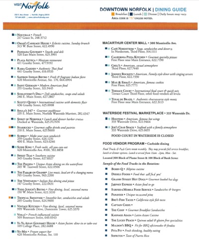
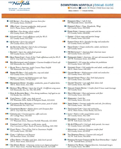
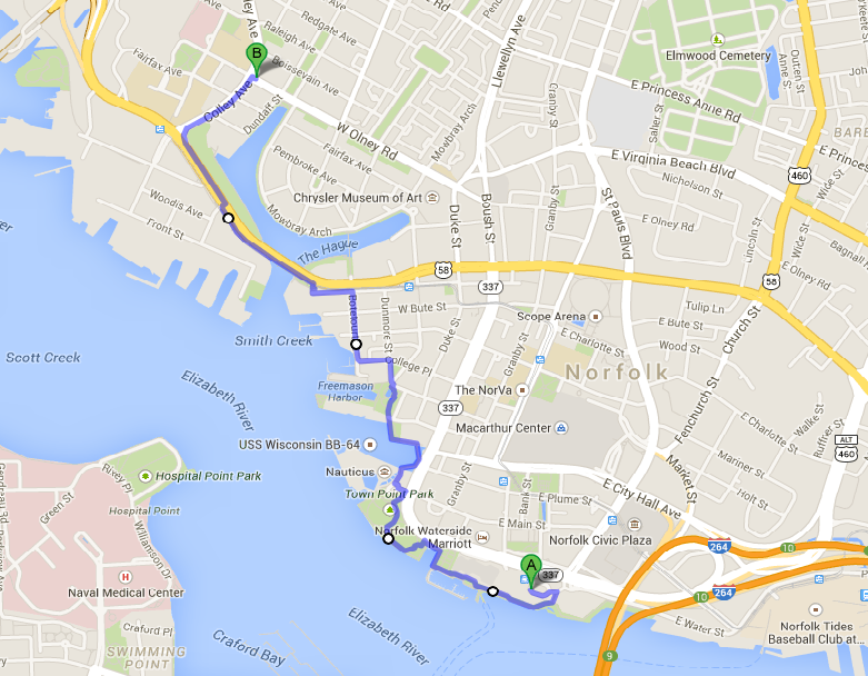
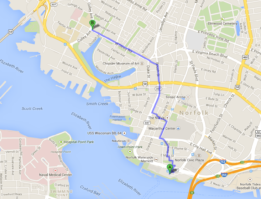
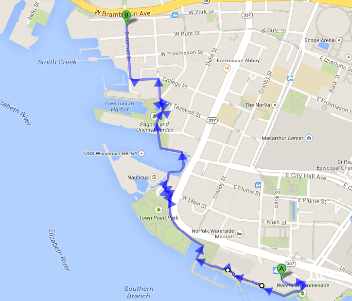
Local Transportation: Participants arriving by air at Norfolk International Airport have several options for ground transportation. The workshop venue is a short taxi ride from the airport (shortest connection is 7.6 miles, roughly 20 minutes and about $25.00). A rental car is only necessary (and recommended) if particants want to visit other locations besides the conference venue. WeatherWeather: The forecast for the period March 21 to 26, 2015 is indicating that there will be partly sunny weather with a chance of rain towards Thursday and Friday. Day temperatures will be somewhere in the 9 to 18oC range. See the most recent full forecast here. What to do and visit in Norfolk?Norfolk has many attractions resulting from 400 years of American history impacting the city. A good way of getting an overview is to walk along the “Cannonball Trail,” a self-guided tour through 400 years of Norfolk and American history. Ghent is a historic part of Norfolk. To get from the Sheraton to Ghent, riding the lightrail, called the Tide is a good alternative to walking through down-town (see the map below). Restaurants and BistrosThere are many options for lunch and dinner in walking distance from the Sheraton. The list below gives an overview. An interesting options is also to take the ferry that leave right outside the meeting venue to cross over to Portsmith, where you some nice option for dinner.
Norfolk also has several local breweries that are worth visting if you like beer. One of them is O'Connors Brewing Co. On Wednesday, March 25, 2015, “Wet Tails” is taking place there, which is a social event organized by Wetlands Watch, a local NGO addressing the challenge of sea level rise in the region. It might be an opportunity to mingle with people living in a region challenged by climate change and sea level rise and inceasingly being impacted by it. If you want to go, it is recommended to RSVP here. Another well know brewery is the Smarthmouth Brewing Co at 1309 Raleigh Ave, Norfolk, VA 23507 (Phone: (757) 624-3939). There, you also find a restaurant.
Workshop Dinner
ACCOMMODATIONThe workshop organizers had reserved a bulk of rooms at the conference venue for a group rate of $99.00 for a double room (plus tax) per night. To ensure group rates, reservations had to be made by March 1, 2015. After that date, there was still the possibility to get the group rates, depending on availability of rooms. |